
ꯐꯥꯏꯜ:India Uttar Pradesh location map.svg

ꯐꯥꯏꯜ ꯑꯁꯦꯡꯕ (ꯑꯦꯁ•ꯚꯤ•ꯖꯤ ꯐꯥꯏꯜ, ꯌꯥꯝꯗꯅ ১,০০৬ × ৯৮১ ꯄꯤꯛꯆꯦꯜ, ꯐꯥꯏꯜ ꯆꯥꯎꯕꯒꯤ ꯆꯥꯡ: ৭৭৬ KB)
ꯑꯇꯦꯟꯕꯥ ꯁꯟꯗꯣꯛꯅꯥ ꯇꯥꯛꯄꯥ
| ꯁꯟꯗꯣꯛꯅꯥ ꯇꯥꯛꯄꯥ |
Quadratische Plattkarte, N-S-Streckung 112 %. Geographische Begrenzung der Karte:
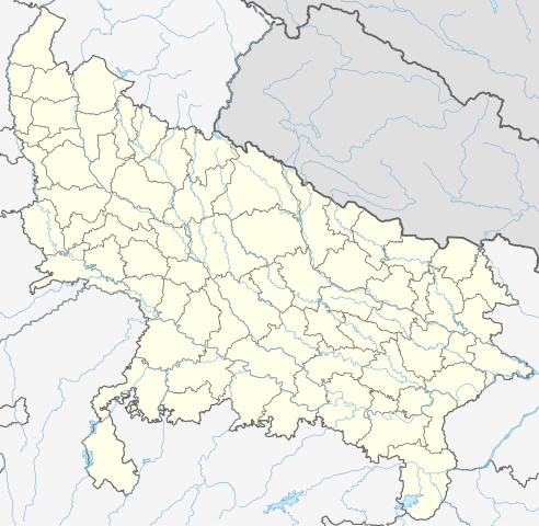
Equirectangular projection, N/S stretching 112 %. Geographic limits of the map:
|
|
| ꯆꯩꯆꯠ | ||
| ꯍꯧꯔꯛꯐꯛ |
ꯏꯁꯥ ꯏꯊꯟꯇꯒꯤ ꯑꯣꯏꯕꯥ ꯊꯕꯛ, using
|
|
| ꯄꯨꯊꯣꯛꯂꯤꯕ ꯃꯤ | NordNordWest | |
| ꯑꯌꯥꯕ ꯂꯧꯕ (ꯃꯁꯤꯒꯤ ꯐꯥꯏꯜꯁꯤ ꯑꯃꯨꯛ ꯍꯟꯅꯥ ꯁꯤꯖꯤꯟꯅꯕꯥ) |
This file is licensed under the Creative Commons Attribution-Share Alike 3.0 Germany license.
 This file is licensed under the Creative Commons Attribution-Share Alike 3.0 Germany license.
|


|
This map has been made or improved in the German Kartenwerkstatt (Map Lab). You can propose maps to improve as well.
|
ꯐꯥꯏꯜꯒꯤ ꯄꯨꯋꯥꯔꯤ
ꯆꯩꯆꯠ/ꯃꯇꯝꯗ ꯅꯝꯃꯨ ꯃꯇꯝ ꯑꯗꯨꯗ ꯐꯥꯏꯜ ꯑꯗꯨ ꯎꯅꯕ
| ꯆꯩꯆꯠ/ꯃꯇꯝ | ꯈꯨꯠꯄꯤꯈꯨꯖꯤꯟ | ꯄꯥꯛ ꯆꯥꯎꯕꯥ | ꯁꯤꯖꯤꯟꯅꯔꯤꯕ | ꯑꯄꯥꯝꯕ ꯐꯣꯡꯗꯣꯛ ꯎ | |
|---|---|---|---|---|---|
| ꯍꯧꯖꯤꯛꯀꯤ | ꯱꯲:꯱꯰, ꯱ ꯃꯦ ꯲꯰꯲꯳ | | ১,০০৬ × ৯৮১ (৭৭৬ KB) | C1MM | c borders |
| ꯱꯰:꯱꯴, ꯵ ꯖꯥꯅꯨꯋꯥꯔꯤ ꯲꯰꯲꯲ |  | ১,০৬৬ × ৯২৭ (৭৭৭ KB) | C1MM | Corrected rivers and dist boundaries | |
| ꯰꯴:꯲꯴, ꯱꯳ ꯐꯦꯕꯨꯋꯥꯔꯤ ꯲꯰꯲꯱ |  | ৯০৯ × ৮৮৬ (২৬২ KB) | C1MM | Added Chhattisgarh | |
| ꯰꯶:꯱꯱, ꯸ ꯖꯥꯅꯨꯋꯥꯔꯤ ꯲꯰꯲꯱ |  | ৯০৯ × ৮৮৬ (২৬১ KB) | C1MM | Added Amethi district | |
| ꯰꯲:꯵꯹, ꯲꯳ ꯑꯦꯄꯔꯤꯜ ꯲꯰꯲꯰ |  | ৯০৯ × ৮৮৬ (২৪৯ KB) | NordNordWest | Reverted to version as of 19:51, 9 October 2012 (UTC); no need to change colours | |
| ꯰꯲:꯳꯰, ꯲꯳ ꯑꯦꯄꯔꯤꯜ ꯲꯰꯲꯰ |  | ৯০৯ × ৮৮৬ (২৯২ KB) | C1MM | Fixed rivers | |
| ꯰꯲:꯲꯱, ꯲꯳ ꯑꯦꯄꯔꯤꯜ ꯲꯰꯲꯰ |  | ৯০৯ × ৮৮৬ (২৯০ KB) | C1MM | Fixed colors and made rivers along borders | |
| ꯰꯱:꯲꯱, ꯱꯰ ꯑꯣꯛꯇꯣꯕꯔ ꯲꯰꯱꯲ |  | ৯০৯ × ৮৮৬ (২৪৯ KB) | NordNordWest | =={{int:filedesc}}== {{Information |Description= {{de|Positionskarte von Uttar Pradesh, Indien}} Quadratische Plattkarte, N-S-Streckung 112 %. Geographische Begrenzung der Karte: * N: 30.5° N * S: 23.8° N * W: 77.... |
ꯐꯥꯏꯜꯒꯤ ꯁꯤꯖꯤꯟꯅꯐꯝ
ꯃꯇꯨꯡ ꯏꯟꯕ ꯂꯃꯥꯏꯁꯤꯖꯤꯟꯅꯕ ꯃꯁꯤꯒꯤ ꯐꯥꯏꯜ:
ꯃꯥꯂꯦꯝꯒꯤ ꯊꯥꯛꯇꯥ ꯁꯤꯖꯤꯟꯅꯕꯥ ꯐꯥꯏꯜ
ꯃꯁꯤꯒꯤ ꯐꯥꯏꯜ ꯑꯁꯤ ꯃꯈꯥꯒꯤ ꯑꯇꯩ ꯋꯤꯀꯤꯁꯤꯡꯅ ꯁꯤꯖꯤꯟꯅꯩ:
- ar.wikipedia.org ꯗꯥ ꯁꯤꯖꯤꯟꯅꯩ
- as.wikipedia.org ꯗꯥ ꯁꯤꯖꯤꯟꯅꯩ
- awa.wikipedia.org ꯗꯥ ꯁꯤꯖꯤꯟꯅꯩ
- azb.wikipedia.org ꯗꯥ ꯁꯤꯖꯤꯟꯅꯩ
- اتاوه
- کینتور
- علیپورا
- فولپور
- فولی (هیندوستان)
- ففنا (هیندوستان)
- فارندا
- سارسای ناوار
- ساروخیپورا
- ساراوان, جاونپور
- ساراسارا, یوتار پرادش
- ساراییا بور
- سارایبیرو
- مداوارا کالا
- سانخنی
- ماوجامپور
- ماسکانوا
- سانای, بوداون
- سامرر (هیندوستان)
- کالاند, ایندیا
- مارتین پوروا
- سامبالهرا
- کاکورا
- سالارپور, بوداون
- کایتورا, جاونپور
- ساییان, آقرا
- ساینتال, یوتار پرادش
- سایفای
- کاقارول
- سایدناقار
- ساهاجانپور
- هالاور
- سافدارقانج
- سادپور, یوتار پرادش
- روپایدیها
- رابارلی
- کادار چووک
ꯌꯦꯡꯉꯨ ꯃꯂꯦꯝꯒꯤ ꯊꯥꯛꯀꯤ ꯁꯤꯖꯤꯟꯅꯐꯝ ꯑꯗꯨ ꯃꯁꯤꯒꯤ ꯐꯥꯏꯜꯁꯤꯗ ꯫