
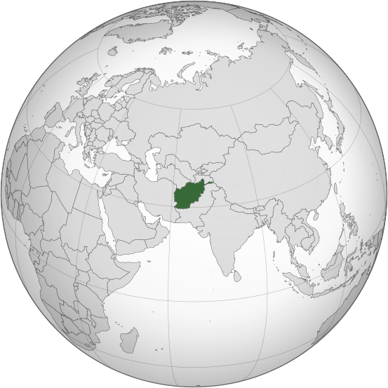
ꯐꯥꯏꯜ:Afghanistan (orthographic projection).svg

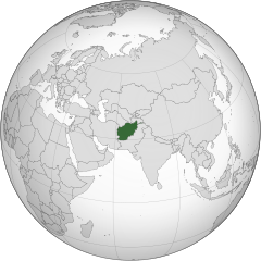
Size of this PNG preview of this SVG file: ৫৫৩ × ৫৫৩ ꯄꯤꯛꯆꯦꯜꯁ. ꯑꯇꯩ ꯁꯦꯡꯅ ꯌꯦꯡꯕ ꯌꯥꯕ: ২৪০ × ২৪০ ꯄꯤꯛꯆꯦꯜꯁ | ৪৮০ × ৪৮০ ꯄꯤꯛꯆꯦꯜꯁ | ৭৬৮ × ৭৬৮ ꯄꯤꯛꯆꯦꯜꯁ | ১,০২৪ × ১,০২৪ ꯄꯤꯛꯆꯦꯜꯁ | ২,০৪৮ × ২,০৪৮ ꯄꯤꯛꯆꯦꯜꯁ.
ꯐꯥꯏꯜ ꯑꯁꯦꯡꯕ (ꯑꯦꯁ•ꯚꯤ•ꯖꯤ ꯐꯥꯏꯜ, ꯌꯥꯝꯗꯅ ৫৫৩ × ৫৫৩ ꯄꯤꯛꯆꯦꯜ, ꯐꯥꯏꯜ ꯆꯥꯎꯕꯒꯤ ꯆꯥꯡ: ২৯৮ KB)
.svg)
ꯑꯇꯦꯟꯕꯥ ꯁꯟꯗꯣꯛꯅꯥ ꯇꯥꯛꯄꯥ
| ꯁꯟꯗꯣꯛꯅꯥ ꯇꯥꯛꯄꯥ |
اردو: طرحی متعامد از افغانستان |
| ꯆꯩꯆꯠ | |
| ꯍꯧꯔꯛꯐꯛ | Own work based on: India (orthographic projection).svg by Ssolbergj |
| ꯄꯨꯊꯣꯛꯂꯤꯕ ꯃꯤ | Shahid Parvez |
| SVG genesis |
.svg)
ꯑꯌꯥꯕꯥ
The map has been created with the Generic Mapping Tools: https://www.generic-mapping-tools.org/ using one or more of these public-domain datasets for the relief:
|

|
ꯁꯤꯟꯗꯣꯛꯅꯕ ꯑꯌꯥꯕꯗꯨ ꯄꯤꯔꯦ, ꯌꯦꯟꯊꯣꯛꯎ ꯑꯃꯁꯨꯡ/ꯅꯠꯇ꯭ꯔꯒ ꯃꯑꯣꯡ ꯱ꯗ ꯁꯦꯝꯗꯣꯛꯎ ꯃꯁꯤꯒꯤ ꯐꯥꯏꯜ ꯑꯁꯤ ꯖꯤ•ꯑꯦꯟ•ꯌꯨ ꯃꯃꯜ ꯇꯤꯡꯗꯕ ꯗꯣꯀꯨꯃꯦꯟꯇꯦꯁꯟꯒꯤ ꯑꯌꯥꯕ ꯌꯥꯅꯕꯒꯤ ꯃꯈꯥꯗ, ꯚꯔꯖꯟ ꯱.꯲ ꯅꯠꯇ꯭ꯔꯒ ꯇꯨꯡꯗ ꯂꯥꯛꯀꯗꯕ ꯚꯔꯖꯟ Free Software Foundationꯅ ꯐꯣꯡꯗꯣꯛꯂꯕ; ꯂꯣꯏꯅꯅ ꯈꯦꯠꯅꯕ ꯁꯔꯨꯛꯁꯤꯡ ꯌꯥꯎꯗꯅ, ꯂꯥꯏꯔꯤꯛꯀꯤ ꯃꯃꯥꯡꯒꯤ ꯃꯈꯨꯝ ꯌꯥꯎꯗꯕꯤ, ꯑꯃꯗꯤ ꯂꯥꯏꯔꯤꯛꯀꯤ ꯑꯔꯣꯏꯕ ꯆꯦꯈꯨꯝ ꯌꯥꯎꯗꯕꯤ ꯫ ꯁꯤꯟꯗꯣꯛꯄ ꯌꯥꯕꯒꯤ ꯑꯌꯥꯕꯁꯤꯡꯁꯤ GNU Free Documentation Licenseꯒꯤ ꯁ꯭ꯔꯨꯛꯁꯤꯡꯗ ꯌꯥꯎꯔꯦ ꯫ |
Original upload log
Transferred from en.wikipedia to Commons by Cirt using CommonsHelper.
The original description page was here. All following user names refer to en.wikipedia.
- 2009-10-05 17:28 Parvez gsm 541×541× (517730 bytes) {{Information |Description = Afghanistan orthographic_projection |Source = I have created this work entirely by myself. |Date = October 5 |Author = Shahid Parvez |other_versions = }}
ꯐꯥꯏꯜꯒꯤ ꯄꯨꯋꯥꯔꯤ
ꯆꯩꯆꯠ/ꯃꯇꯝꯗ ꯅꯝꯃꯨ ꯃꯇꯝ ꯑꯗꯨꯗ ꯐꯥꯏꯜ ꯑꯗꯨ ꯎꯅꯕ
| ꯆꯩꯆꯠ/ꯃꯇꯝ | ꯈꯨꯠꯄꯤꯈꯨꯖꯤꯟ | ꯄꯥꯛ ꯆꯥꯎꯕꯥ | ꯁꯤꯖꯤꯟꯅꯔꯤꯕ | ꯑꯄꯥꯝꯕ ꯐꯣꯡꯗꯣꯛ ꯎ | |
|---|---|---|---|---|---|
| ꯍꯧꯖꯤꯛꯀꯤ | ꯲꯰:꯱꯶, ꯲꯷ ꯖꯨꯂꯥꯏ ꯲꯰꯱꯹ | | ৫৫৩ × ৫৫৩ (২৯৮ KB) | Cerebellum | Revert to prior version, please provide a source for those territorial claims |
| ꯱꯵:꯵꯹, ꯲꯶ ꯖꯨꯂꯥꯏ ꯲꯰꯱꯹ |  | ৭২০ × ৭২০ (৩৮৪ KB) | Lakshmisreekanth | Updated color | |
| ꯲꯲:꯳꯰, ꯲꯵ ꯖꯨꯂꯥꯏ ꯲꯰꯱꯹ |  | ৭২০ × ৭২৭ (৩৯৭ KB) | Lakshmisreekanth | Added claimed regions | |
| ꯰꯵:꯰꯶, ꯱꯷ ꯃꯥꯔꯆ ꯲꯰꯱꯵ |  | ৫৫৩ × ৫৫৩ (২৯৮ KB) | Flappiefh | Removed Somaliland and Kosovo. Separated Western Sahara and Morroco. | |
| ꯱꯸:꯱꯳, ꯴ ꯑꯒꯁ ꯲꯰꯱꯳ |  | ৫৫৩ × ৫৫৩ (৩০২ KB) | Flappiefh | Added South Sudan. The map is now centered on Afghanistan. | |
| ꯰꯴:꯱꯵, ꯲꯱ ꯅꯣꯚꯦꯝꯕꯔ ꯲꯰꯰꯹ |  | ৫৪১ × ৫৪১ (৫০৬ KB) | File Upload Bot (Magnus Manske) | {{BotMoveToCommons|en.wikipedia|year={{subst:CURRENTYEAR}}|month={{subst:CURRENTMONTHNAME}}|day={{subst:CURRENTDAY}}}} {{Information |Description={{en|Afghanistan orthographic_projection}} |Source=Transferred from [http://en.wikipedia.org en.wikipedia]; |
ꯐꯥꯏꯜꯒꯤ ꯁꯤꯖꯤꯟꯅꯐꯝ
ꯃꯇꯨꯡ ꯏꯟꯕ ꯂꯃꯥꯏꯁꯤꯖꯤꯟꯅꯕ ꯃꯁꯤꯒꯤ ꯐꯥꯏꯜ:
ꯃꯥꯂꯦꯝꯒꯤ ꯊꯥꯛꯇꯥ ꯁꯤꯖꯤꯟꯅꯕꯥ ꯐꯥꯏꯜ
ꯃꯁꯤꯒꯤ ꯐꯥꯏꯜ ꯑꯁꯤ ꯃꯈꯥꯒꯤ ꯑꯇꯩ ꯋꯤꯀꯤꯁꯤꯡꯅ ꯁꯤꯖꯤꯟꯅꯩ:
- ady.wikipedia.org ꯗꯥ ꯁꯤꯖꯤꯟꯅꯩ
- af.wikipedia.org ꯗꯥ ꯁꯤꯖꯤꯟꯅꯩ
- ami.wikipedia.org ꯗꯥ ꯁꯤꯖꯤꯟꯅꯩ
- arc.wikipedia.org ꯗꯥ ꯁꯤꯖꯤꯟꯅꯩ
- ar.wikipedia.org ꯗꯥ ꯁꯤꯖꯤꯟꯅꯩ
- arz.wikipedia.org ꯗꯥ ꯁꯤꯖꯤꯟꯅꯩ
- ast.wikipedia.org ꯗꯥ ꯁꯤꯖꯤꯟꯅꯩ
- as.wikipedia.org ꯗꯥ ꯁꯤꯖꯤꯟꯅꯩ
- av.wikipedia.org ꯗꯥ ꯁꯤꯖꯤꯟꯅꯩ
- awa.wikipedia.org ꯗꯥ ꯁꯤꯖꯤꯟꯅꯩ
- azb.wikipedia.org ꯗꯥ ꯁꯤꯖꯤꯟꯅꯩ
- az.wikipedia.org ꯗꯥ ꯁꯤꯖꯤꯟꯅꯩ
- az.wiktionary.org ꯗꯥ ꯁꯤꯖꯤꯟꯅꯩ
- ba.wikipedia.org ꯗꯥ ꯁꯤꯖꯤꯟꯅꯩ
- bbc.wikipedia.org ꯗꯥ ꯁꯤꯖꯤꯟꯅꯩ
- be-tarask.wikipedia.org ꯗꯥ ꯁꯤꯖꯤꯟꯅꯩ
- be.wikipedia.org ꯗꯥ ꯁꯤꯖꯤꯟꯅꯩ
- bg.wikipedia.org ꯗꯥ ꯁꯤꯖꯤꯟꯅꯩ
- bh.wikipedia.org ꯗꯥ ꯁꯤꯖꯤꯟꯅꯩ
- bi.wikipedia.org ꯗꯥ ꯁꯤꯖꯤꯟꯅꯩ
- bn.wikipedia.org ꯗꯥ ꯁꯤꯖꯤꯟꯅꯩ
- bn.wikivoyage.org ꯗꯥ ꯁꯤꯖꯤꯟꯅꯩ
- br.wikipedia.org ꯗꯥ ꯁꯤꯖꯤꯟꯅꯩ
ꯌꯦꯡꯉꯨ ꯃꯂꯦꯝꯒꯤ ꯊꯥꯛꯀꯤ ꯁꯤꯖꯤꯟꯅꯐꯝ ꯑꯗꯨ ꯃꯁꯤꯒꯤ ꯐꯥꯏꯜꯁꯤꯗ ꯫
.svg)
.svg)