ꯎꯠꯇꯔ ꯄ꯭ꯔꯗꯦꯁ
Appearance
| ꯎꯇꯥꯔ ꯄ꯭ꯔꯗꯦꯁ | ||
|---|---|---|
| ꯁ꯭ꯇꯦꯠ | ||
|
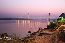
Clockwise from top: Taj Mahal, Agra Fort, Fatehpur Sikri, Sarnath, Manikarnika Ghat, New Yamuna Bridge | ||
| ||
 Location of Uttar Pradesh in India | ||
 | ||
| Coordinates: 26°51′N 80°55′E / 26.85°N 80.91°Eꯀꯣꯑꯣꯔꯗꯤꯅꯦꯠꯁ: 26°51′N 80°55′E / 26.85°N 80.91°E | ||
ꯎꯇꯔ ꯄ꯭ꯔꯗꯦꯁ (/ˌʊtər ![]() listen)) ꯑꯁꯤ ꯏꯟꯗꯤꯌꯥꯒꯤ ꯁ꯭ꯇꯦꯠ ꯑꯃꯅꯤ꯫ ꯃꯁꯤ ꯆꯥꯎꯔꯥꯛꯅ ꯃꯤꯑꯣꯢ ꯃꯤꯂꯤꯌꯟ ꯲꯰꯰ ꯃꯨꯛꯅ ꯈꯨꯟꯗꯥꯕ ꯂꯝ ꯑꯃꯅꯤ꯫ [꯱] ꯃꯁꯤ ꯱꯹꯳꯷ ꯒꯤ ꯑꯦꯄ꯭ꯔꯤꯜ ꯱ ꯗ ꯑꯥꯒ꯭ꯔꯥ ꯑꯃꯗꯤ ꯑꯧꯙ ꯀꯤ ꯑꯄꯨꯟꯕ ꯂꯝꯂꯦꯟꯁꯤꯡ ꯍꯥꯢꯅ ꯁꯦꯝꯈꯤ ꯫ ꯑꯗꯨꯒ ꯕ꯭ꯔꯤꯇꯤꯁ ꯂꯩꯉꯥꯛꯀꯤ ꯃꯈꯥꯗ ꯱꯹꯵꯰ꯗ "ꯎꯠꯇꯔ ꯄ꯭ꯔꯗꯦꯁ" ꯍꯥꯢꯅ ꯃꯤꯡꯊꯣꯟꯈꯤ ꯫
listen)) ꯑꯁꯤ ꯏꯟꯗꯤꯌꯥꯒꯤ ꯁ꯭ꯇꯦꯠ ꯑꯃꯅꯤ꯫ ꯃꯁꯤ ꯆꯥꯎꯔꯥꯛꯅ ꯃꯤꯑꯣꯢ ꯃꯤꯂꯤꯌꯟ ꯲꯰꯰ ꯃꯨꯛꯅ ꯈꯨꯟꯗꯥꯕ ꯂꯝ ꯑꯃꯅꯤ꯫ [꯱] ꯃꯁꯤ ꯱꯹꯳꯷ ꯒꯤ ꯑꯦꯄ꯭ꯔꯤꯜ ꯱ ꯗ ꯑꯥꯒ꯭ꯔꯥ ꯑꯃꯗꯤ ꯑꯧꯙ ꯀꯤ ꯑꯄꯨꯟꯕ ꯂꯝꯂꯦꯟꯁꯤꯡ ꯍꯥꯢꯅ ꯁꯦꯝꯈꯤ ꯫ ꯑꯗꯨꯒ ꯕ꯭ꯔꯤꯇꯤꯁ ꯂꯩꯉꯥꯛꯀꯤ ꯃꯈꯥꯗ ꯱꯹꯵꯰ꯗ "ꯎꯠꯇꯔ ꯄ꯭ꯔꯗꯦꯁ" ꯍꯥꯢꯅ ꯃꯤꯡꯊꯣꯟꯈꯤ ꯫
ꯃꯇꯦꯡ ꯂꯧꯐꯝ
[ꯁꯦꯝꯒꯠꯂꯨ | ꯁꯦꯝꯒꯠꯂꯛꯄꯒꯤ ꯍꯧꯔꯛꯐꯝ]| ꯋꯤꯀꯤꯃꯦꯗꯤꯌꯥ ꯀꯃꯣꯟꯁꯀꯥ ꯃꯔꯤꯂꯩꯅꯕ ꯃꯦꯗꯤꯌꯥ ꯎꯠꯇꯔ ꯄ꯭ꯔꯗꯦꯁ ꯇ ꯌꯥꯎꯔꯦ ꯫ |
- ↑ "If Uttar Pradesh were a country" (in en)꯫ Quartz India꯫ 11 October 2017 ꯫ ꯆꯠꯅꯕ ꯆꯩꯆꯠ - 20 May 2019 ꯫ ꯫
|
ꯃꯆꯥꯈꯥꯏꯕꯁꯤꯡ:
- ꯁꯝꯂꯞꯄ ꯋꯥꯔꯣꯜ ꯌꯥꯎꯕ ꯋꯥꯔꯦꯡꯁꯤꯡ
- Coordinates on Wikidata
- ꯈꯣꯟꯊꯣꯛ ꯌꯥꯎꯔꯕ ꯋꯥꯔꯦꯡꯁꯤꯡ
- Commons category link is on Wikidata
- Wikipedia articles with BNF identifiers
- Pages with red-linked authority control categories
- Wikipedia articles with GND identifiers
- Wikipedia articles with LCCN identifiers
- Wikipedia articles with NKC identifiers
- Wikipedia articles with VIAF identifiers
- ꯏꯟꯗꯤꯌꯥ ꯁ꯭ꯇꯦꯠꯁꯤꯡ


